Ice Core Science
In this section you can learn more about the science conducted at EastGRIP.
- Watch a short movie about the science at EastGRIP
- Read about drilling of the main ice core
- The EastGRIP associated projects (2019)
- Or immerse yourself in popular science papers
Ice cores - Revealing secrets of past climate
Video from UiB - Universitetet i Bergen.
Ice core drilling
Ice core drilling in Greenland was initiated in 1955 and since then numerous of short ice cores and several deep ice cores have been retrieved from the Greenland Ice Sheet. At EastGRIP we aim to drill an ice core through more than 2550m of ice.
The ice core can provide us with a range of information both on the dynamics of the ice (how the ice 'behaves') and on past climate (temperature, greenhouse gas concentration, vulcanic eruptions etc.).
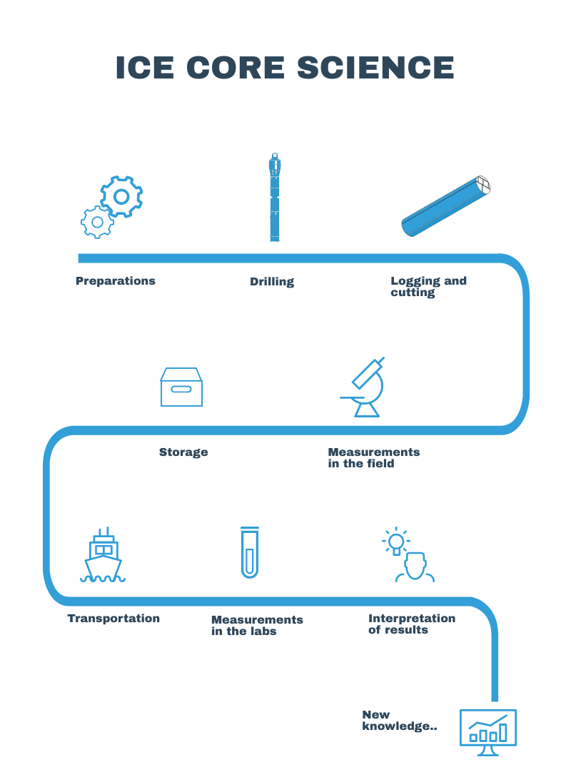
Below you can click on the interactive map to learn more about how we drill the ice core, the following (laboratory) analyzes and the knowledge that can be derived from the measurements.
In addition to drilling the main ice core through an ice sheet measuring more than 2500m, a range of other projects and measurements are also conducted at the site, this including drilling of short ice cores (shallow drilling), a range of measurements on the surface of the snow (e.g. snow accumulation, vapour and gas content and radiation), drone measurements, radar measurements and much more.
Preparations
- construction of camp
Ice cores needs to be kept at low temperatures (-20°C or colder). Therefore, both drilling and measurements are done in manmade ‘caves’ under the snow surface.
These caves are built by digging trenches in which giant balloons are inflated and covered with snow. Once the snow has stabilized the balloons can be deflated leaving a cavity.
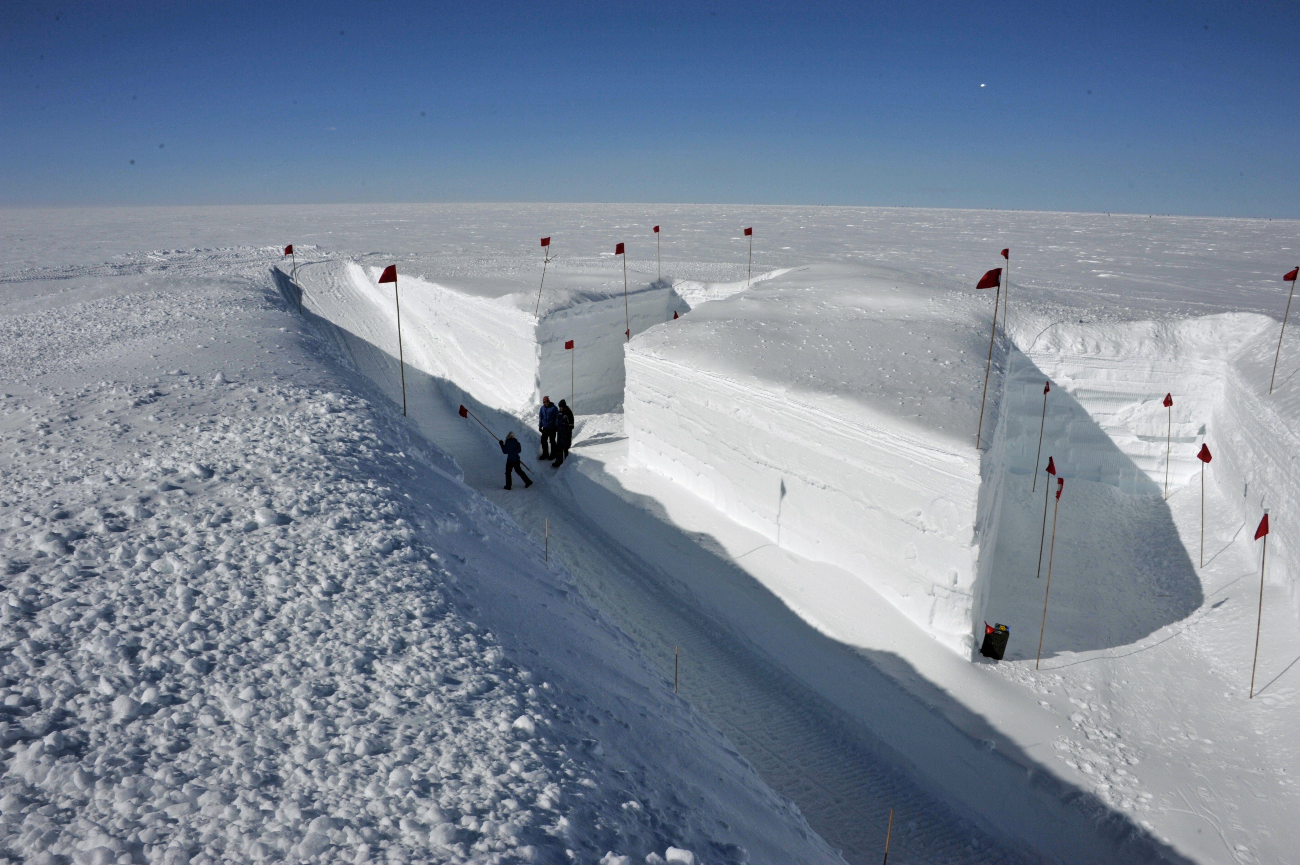 The excavations are on the way of the science trench, but there is still a long way to go. The pit will reach seven metres deep when the excavation is finished.
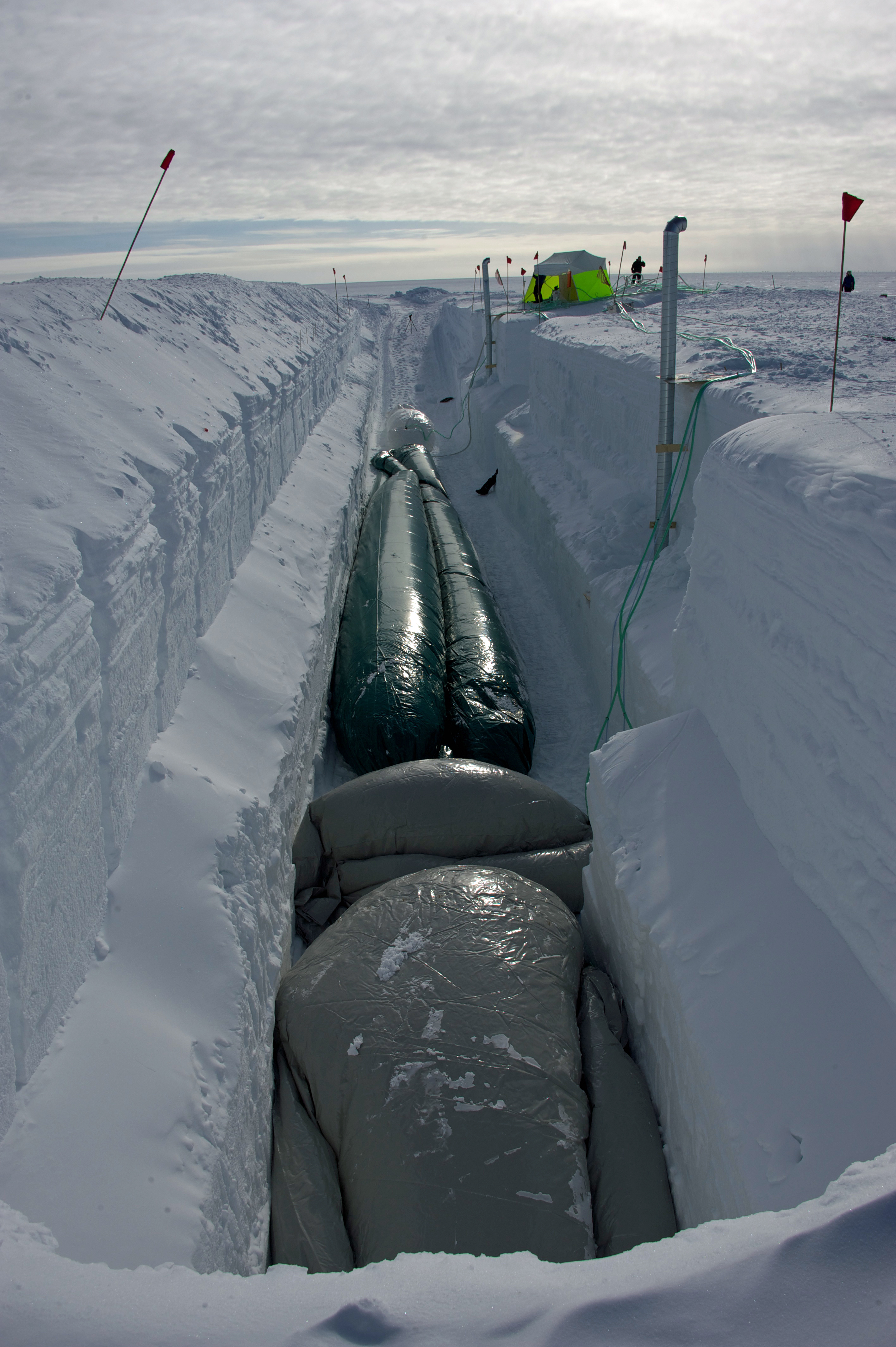 The future trenches are slowly being filled with the huge balloons which are baing inflated.
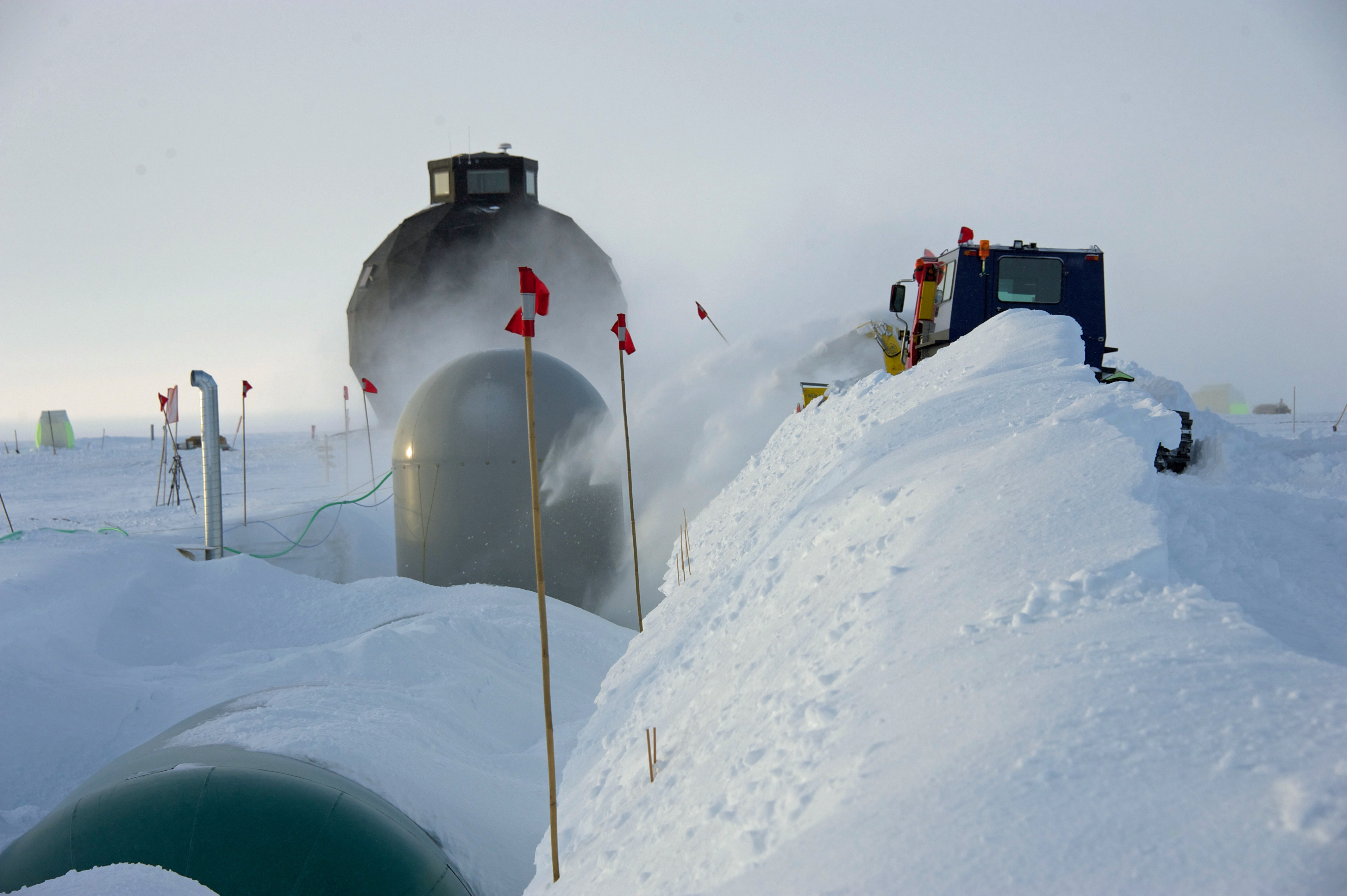 The balloons are slowly covered with the snow that was previously excavated to make the trenches. After a couple of days the snow will have formed a rock-solid roof.
Much of the 2016 field season was used to transform the freshly blown balloon trench into a working drilling trench with the aim to start deep drilling in early 2017.
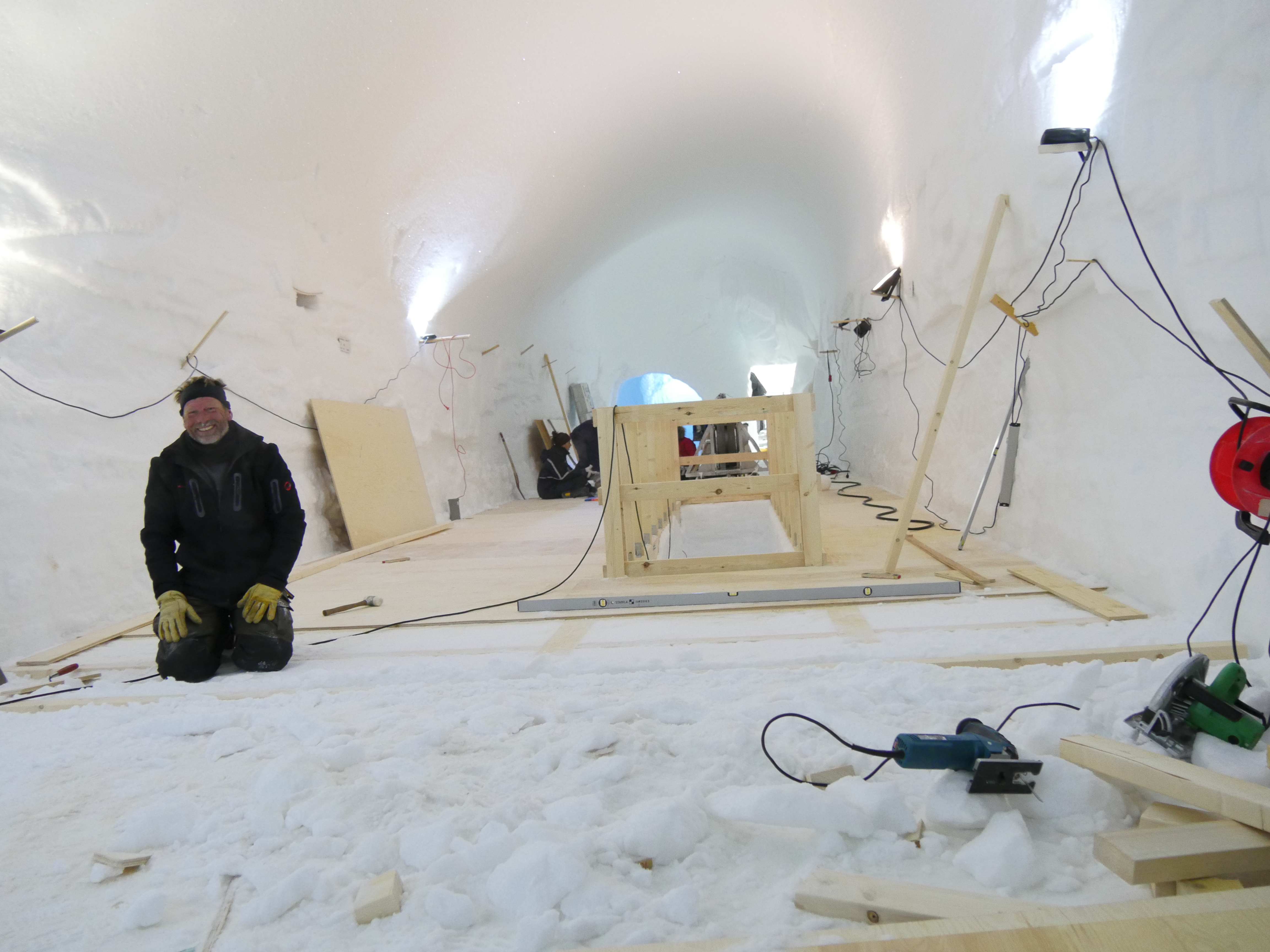 Construction of a drill trench floor and installation of the drill tower was a huge part of the 2016 field season.
In the beginning of the field season 2017 installation of deep drill apparatus was completed. This includes among others electrical systems in trench and systems for handling ice chips and fluids (see section on drilling). The beginning of the early field season 2017 was also used to make the infrastructure of the science trench.
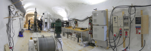 Drill trench viewed from the entrance end with the winch in the foreground and electrical installations to the right. The drillers are tilting the tower to extract the ice core. Drillers control cabin to the right of the tower. Drillers workshop in the background.
Drilling
The drilling of the main ice core began late in the 2016 field season, so the borehole casing could be installed in the beginning of the 2017 season before the main drilling could start.
To drill the ice core a special ice core drill has been developed by a group at the Centre for Ice and Climate. The ice core drill is mounted to a cable and contains all necessary electronics and a motor.
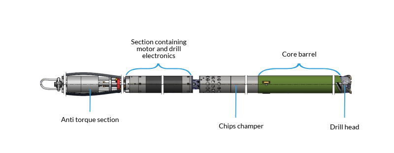 Schematic draving of drill with 2.2 m core barrel used in 2017 at EGRIP. Notice that the drawing is shortened at several points marked by white 'lines'.
The drill head rotates and cuts its way through the ice using knives. The core barrel consists of an inner and an outer part. The inner barrel is covered with spirals (see picture below). The ice core is pushed into the inner core barrel, while excess ice in the form of ice chips is transported between the inner and outer core barrels using the thick spirals. The ice chips are then pumped into the chips champer.
 Fresly drilled ice core still in the ice core barrel
Once the drill is filled with ice the rotation stops and the process of raising the drill using a winch starts. "Core-catchers", small spring-loaded knives, cut into the ice core and prevents it from gliding out of the drill while it is being pulled towards the surface.
Once the drill reaches the surface the tiltable drill tower makes it possible to transport the core in the core barrel to the extraction freezer where the core is pushed into a tray for further processing.
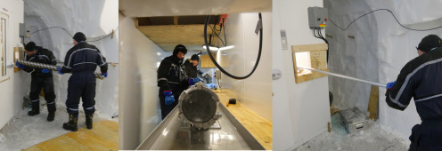 Drillers Dennis and Sune push the core barrel containing ice core into the extraction freezer (left), where Lydia and Emilie wait to receive it. The bottom of the ice core is visible in the barrel (middle). Sune is then pushing the core out of the core barrel into a tray (right). – Or is he baking a pizza?
Visit the EGRIP trenches, including the drilling trench, in this 360° film by By Susanne Buchardt, DIS
Even though the actual drilling takes about a quarter of an hour it can take up to three hours from drilling to the point where the ice core reaches the surface. The time is used to transport the drill up and down in the borehole and servicing the drill section at the surface
The conditions are not alike throughout the ice. Thus, the drilling setup has to be changed at certain depths.
For example, the length of the ice cores drilled changes. At the top part of the ice, cores of about 2m are drilled. This is especially important in a certain section of the ice called the ‘brittle zone’. In this section the ice is fragile. Once the drilling passes this zone longer ice cores of about 3.5 meters are drilled.
Another condition that changes with depth is pressure. At the bottom of the ice sheet the pressure is approx. 280 atmospheres because of the enormous weight of the ice above. Due to the high pressure a borehole will quickly close. To prevent this from happening borehole fluid of approximately the same density as the surrounding ice is used.
On the Centre for Ice and Climates website you can find further information on drilling techniques and development of the drills.
Logging and cutting
LoggingLogging and documentation of ice core quality and integrity is done inside an active freezer unit installed in the logging tunnel. Here, the temperature is approx. -30°C. The tunnel is kept low in order to ensure, that the temperature is close to the temperature of the ice sheet.
To begin with the drill fluid is removed from the ice core using a vacuum cleaner. Hereafter, the top of the newest core piece is fitted to the bottom of the previous core piece. By checking that the two pieces fit precisely together, the possibility of loss of ice core can be ruled out. The length of the core is then measured. It is the sum of all these measured core lengths that gives the total length of the ice core. The core length is different from the measured drill cable length because the cable is stretched by the weight of cable and drill. The core is then marked in sections called "bags". Each bag is 0.55 m and three bags, i.e. 1.65 m, constitute a processing "run".
CuttingCutting of sample sections is done using a horizontal band saw, or swiss saw (a vertical saw). Below you can see the EGRIP cutting scheme marking which cuts will be performed. However, not all of the cuts are done at once and some cuts are not performed at all in the field; regarding the ice before and in the brittle zone the CFA gas and CFA chem sections are cut once the ice is back in Europe. The SC and main sections constitute the "archive piece" - these two sections will not be split in the field either).
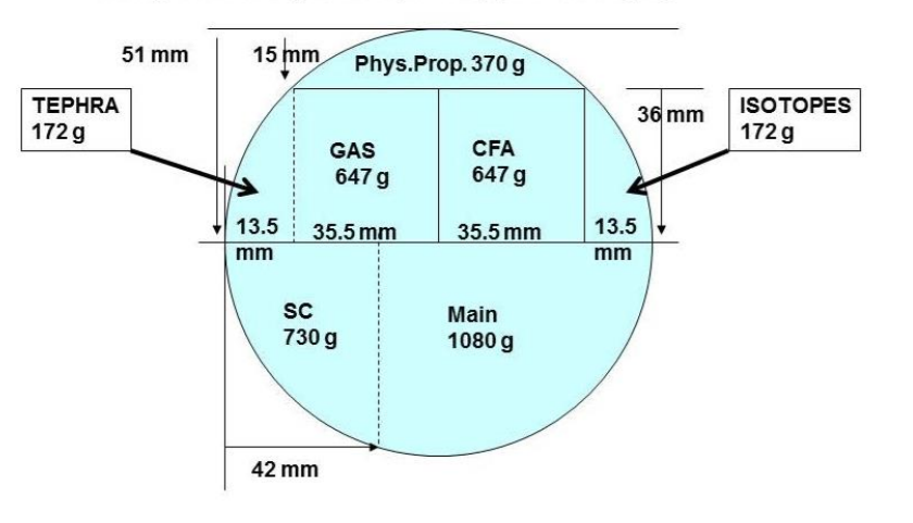 Cutting Scheme from EastGRIP main core
Measurements in the field
Some measurements are conducted in the field, while others are done in the labs back at the laboratories at the participating universities. Before the measurements can be performed, the ice core is cut into different pieces (see previous section). Below you can see a schematic drawing showing which part of the ice core is assigned to the different measurements. In this section you can read more about the measurements performed in the field.
 Cutting Scheme from EastGRIP showing which parts of the ice core that is assigned for different measurements
Di-electric properties measurements (DEP)
An integrated AWI (Alfred Wegener Institute) system records di-electric properties on the full and uncut core. This method is used for measurements of the ion content of the ice. The scientific explanation of the technique is quite complex and will not be explained in details here. However, the overall idea is to build a capacitor consisting of an uncut ice core placed in between two conducting plates. The capacitans is measured along the lenght of the ice core. Because the capacitans is influenced by the amount of ions present in the ice, the DEP can be used as a measurement of the ion content.Electrical Conductivity Measurements (ECM)
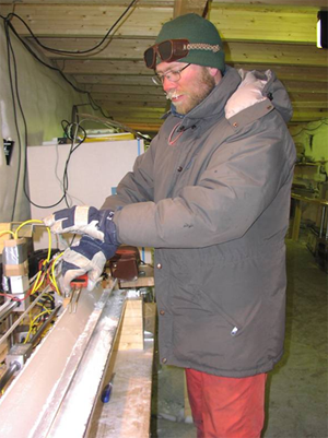 ECM measurements being carried out After the first cut in the horizontal saw, the core will be mounted in the Danish ECM setup for conductivity measurements.
First the core is cleaned with a microtome knife. Hereafter, the electric conductivity of the ice is measured by moving two electrodes with an electrical potential difference of about 1000 V along the ice surface. The resulting current is a measure of the acidity of the ice. A significant feature of this so-called ECM record is that it contains large peaks caused by past volcanic eruptions. During the eruption large amounts of sulfur dioxide (SO2) are released to the atmosphere, where it is eventually turned into sulphuric acid (H2SO4), which shows up in the ECM record.
Line Scanning
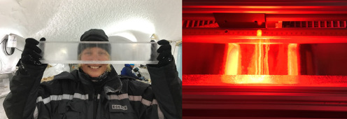 Left: Christine looking through a glacial section of the EGRIP core, showing that it is nearly completely transparent. Right: but in the line scanner it is easy to see that the cores in fact contain many cloudy bands
Glacier ice contains visible layers called cloudy bands. Especially in the relatively dirty glacial ice, the layers are related to the content of dust and other impurities and can be used for dating purposes. The layers are not clearly visible in the freshly drilled ice core, as the core surface is scratched by the cutters.
Before cutting the tephra and isotope pieces the 36 mm thick central slab will be polished on both sides with a microtome knife and scanned in the AWI line scanner, which records these visual layers in the core.
On the Center for Ice and Climates website you can read more about Line scanning
Measurements in warm laboratories
Inside the science trench there are two warm laboratories. In one, continuous measurements of stable water isotopes on sticks of ice core are performed and in the other measurements on physical properties are conducted.Stable water isotope measurements
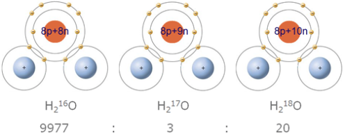 An atom is composed of a nucleus and one or more electrons bound to the nucleus. The nucleus is made of one or more protons and typically a similar number of neutrons. However, the number of neutrons can vary and the different variants of the same atom is thus called isotopes. Below three different water molecules formed from 2 hydrogen atoms and different oxygen isotopes (similar, but with different number of neutrons in the nucleus) are depicted. The most common form is H216O. For each 10,000 water molecules in nature, only 3 are H217O and 20 are H218O.
A water molecule consists of one oxygen atom and two hydrogen atoms. However, the atoms can vary with respect to the number of neutrons (see picture to the right). This means that some of the water molecules will be heavier than others.
The maximum amount of moisture that air can hold drops with decreasing temperatures. When humid air cools, at some point the water molecules will condensate to form precipitation. As the heavier isotopes have a slightly larger tendency to condensate, the humid air mass will gradually lose relatively more and more of the water molecules containing heavy isotopes (18O and Deuterium; D or 2H). Every time precipitation forms, the air mass will become more depleted in heavy isotopes. In the language of physics, fractionation takes place. During cold conditions (e.g. during winter or in a cold climatic period), the air masses arriving in Greenland have cooled more on the way, thereby having formed more precipitation and the remaining vapor is therefore more depleted in heavy isotopes (corresponding to lower δ18O vales). Thus, the isotope values in the snow falling at the Greenland ice sheet reflects the level of rain-out from the air mass, which correlates with temperature. Therefore, by measuring the isotope composition in the ice core it is possible to reconstruct the annual temperature variations year by year.
For the active days, approx. 13-15 meters of ice core can be processed per day in camp using a method called Continous Flow Analyses (CFA). You can read more about the method in the 'measurements in labs' section.
Measurements of physical properties
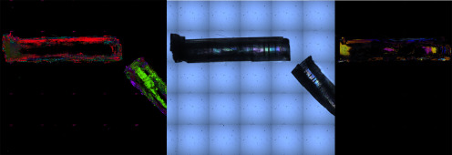 Ice crystals in different types of polarized light. The squares are 1 cm on each side.
The phrase "Physical Properties" covers a range of different measurements. Many of these measurements are conducted in laboratories at the universities participationg in the projects (e.g. the Alfred-Wegener-Institute in Germany). However, for the analyses that require fresh ice, systems will be set up in the science trench and in the before mentioned designated warm lab. Here, the physical properties of the ice, e.g. the crystal structure, is measured.
Storage
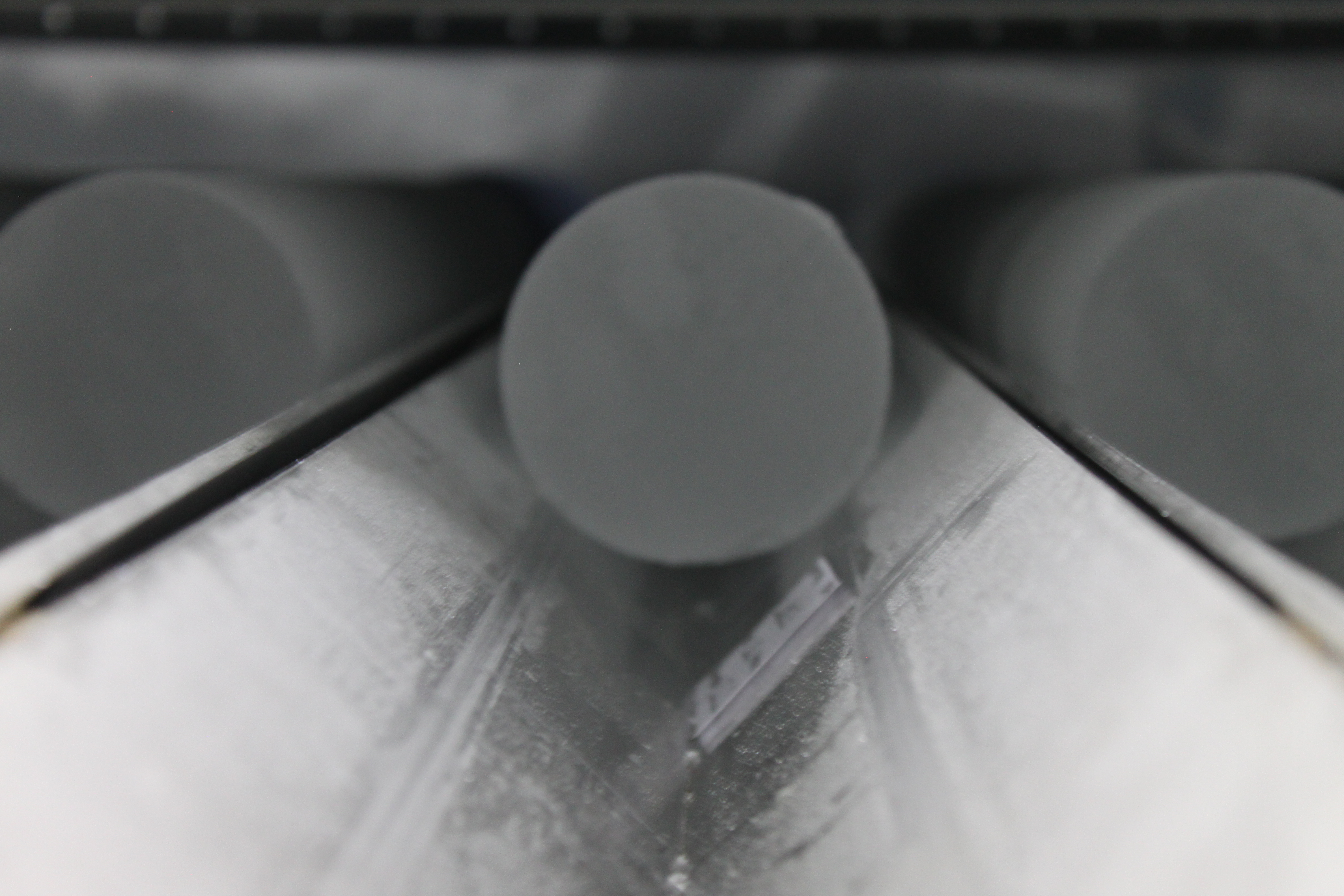 Ice core in core buffer
Ice cores needs to be kept at low temperatures (-20°C or colder). In the field ice core's are stored under the surface of the ice in "caves" similar to the trenches described under "Preparations".
Brittle ice is stored in the ice core buffer prior to being processed. The cores are left in the core buffer over winter so they are less brittle when processed in the science trench.
The ice that is being shipped back to Copenhagen (see previous sections) will be stored in large freezers which holds the ice core archive. The archive contains a total of 15 km of ice from several Greenland deep drillings and many other drilling projects. The archive makes it possible to study the old cores when new measurement techniques are developed or new ideas emerge.
Transportation
From the EastGRIP camp the ice is flown to Kangerlussuaq (Danish name: Søndre Strømfjord) in the south western part of Greenland. Kangerlussuaq has long been a logistical focal point for scientific expeditions, because it can be reached by direct flight from Copenhagen and has the best airport and some of the best weather conditions in Greenland. Both People and cargo (including ice cores) are transported in large LC-130 Hercules airplanes operated by the 109th division of the New York Air Guard.
In Kangerlussuaq the ice is stored in a freezer. Hereafter, most of the ice shipped back to Denmark and finally transported by truck to the Centre for Ice and Climate or other storage facilities. Throughout the journey it is of the uppermost importance that the ice is kept under low temperatures.
Measurements in the lab
Gas Analysis
Gas bubbles trapped in the ice when an ice core can be analysed in order to determine the composition of the atmosphere hundreds of thousand years back in time. This is done either by by melting content (e.g. for analysis of the CH4 or N2O) or crushing the ice (for anlysis of the CO2 content), thus releasing the samples of past atmospheric air from the ice and analysed.
Concentration measurements can be performed using a gas chromatograph (GC), where isotope ratios are determined using mass spectrometry.
You can read more about sampling and analysing the gas here .
CFA
CFA is short for 'Continous Flow Analysis' - a method used to prevent contamination of samples thereby enableing measurements of impurities of very low concentration in the ice.
In short the ice is melted in a way so only the clean inner part is used for the analysis:
A part of the drilled ice core is melted continuously at a speed of approx. 3 cm/min on a gold coated plate which is located in a cold lab (–20°C). Only the inner part which was never in contact with ambient air is used and is pumped into a warm lab, whereas the possibly contaminated water from the outer part is rejected. The melt water stream still contains air bubbles (approx. 10% of the total volume) from the enclosed air in the ice.
The air is removed in a so-called debubbler, before the sample stream is split and passed into a number of analysis systems, in which the following records are obtained:
- The amount of insoluble dust, and the size distribution of the particles.
- The concentration of NH4+, Ca2+, NO3–, Na+, SO42–, HCHO, and H2O2.
- The conductivity of the melt water (which is tightly connected with the ion content)
The impurities come from different sources and thus yield different information about the climate system. Some of the impurities have an annual cycle, and these records can therefore be used for identification of the annual layers in the ice. One example is Ca2+, which comes mainly from dust and has highest concentration in spring.
Tephra samples
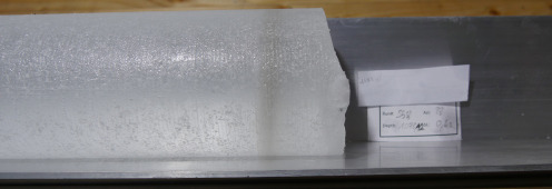 A visible volcanic ash layer in the ice core at 1078 m depth (drillers’ depth). Possibly the well-known 10,400 yr old Saksunarvatn tephra layer.
When large volcanic eruptions occur, huge quantities of acids are introduced into the atmosphere and distributed over vast areas. In ice cores, volcanic layers can sometimes be identified by volcanic ash particles (tephra), but more often the layers only contain elevated concentrations of acids seen in the ice cores as mainly sulphate and sometimes fluoride. In Greenland the nearby Icelandic and Alaskan volcanoes have a strong imprint in the ice cores. However, if the volcanic eruptions are strong enough to inject acids into the stratosphere, also volcanoes from the tropics or even the southern hemisphere can be identified in Greenland. Examples of well-known historic volcanoes that have left a clear fingerprint in all Greenland ice cores are Tambora, Indonesia (1815), Krakatau, Indonesia (1883), Katmai, Alaska (1912), El Chichón, Mexico (1982), and Mount Pinatubo, Philippines (1991).
The largest volcanic events are also impacting global climate by injecting large amounts of small particles (so-called aerosols) into the stratosphere thereby partially shielding the Earth from solar radiation and reducing temperatures. The impact of volcanoes on past climate is constrained from the long records of past volcanism reconstructed from Greenland and Antarctic ice cores.
Acid and tephras from volcanic eruptions are also used for dating purposes and for linking ice cores with other climate archive.
Interpretation of results
Once measurements are completed the results needs to be processed.
This involves statistical analysis and comparison with previous findings.
In order to use the measurements from an ice core they need to be linked to a specific time or period. Establishing a time scale for the ice core is done using a combination of annual layer counting and computer modelling. Ice core time scales can be applied to other ice cores or even to other archives of past climate using common horizons in the archives.
A variety of climate models are used to improve our understanding of the climate and interpret ice core data. From complex models running on supercomputers to simple models running on a home pc, each experiment is tailored to match the objectives. How and why did climate vary in the past? How is this reflected in ice core data? What are the implications for future climate?
ASSOCIATED PROJECTS
Click on each project to learn more..
NEEM borehole logging
Dorthe Dahl-Jensen, Niels Bohr Institute & Uni. Of Manitoba
NEEM borehole logging
Dorthe Dahl-Jensen, Niels Bohr Institute & Uni. Of Manitoba
When an ice core has been drilled there is still information to be gained by studying the borehole itself. A instrument measuring the geometry of the borehole and the temperature of the surrounding ice is lowered into the borehole. The changes in the shape of the borehole since the ice core was drilled give information on the flow of the ice, and the measured temperatures reveal the past temperatures at the site.
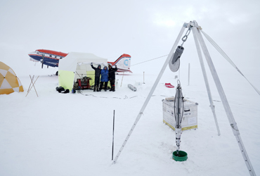
The A team of two people was flown to NEEM to perform a logging of the NEEM borehole. On May 16 Polar 5 (AWI) took off with Dorthe and Sepp, heading for the old NEEM site. After assisting Dorthe and Sepp setting up equipment and camp, the Polar 5 crew returned to EGRIP. This was the first time since 2015 the NEEM site was manned. The borelogging was not without setbacks; On May 17 Dorthe and Sepp reported to camp that the NEEM bore hole had a block some 100 m down. Saturday (May 18), Trevor and Steff flew to NEEM with bore hole camera and reaming equipment. After 5 hours, the ice blockage was removed and bore hole logging continued, and Trevor and Steff returned to EGRIP. Logging continued throughout the evening and however, the next afternoon, the logger got stuck at a very narrow point in the bore hole at 2433m depth. The crew managed to get the logger un-stuck, and logging was completed in the evening.

Trevor, Dorthe and Steff at the NEEM borehole where the logger is now ready to be deployed.
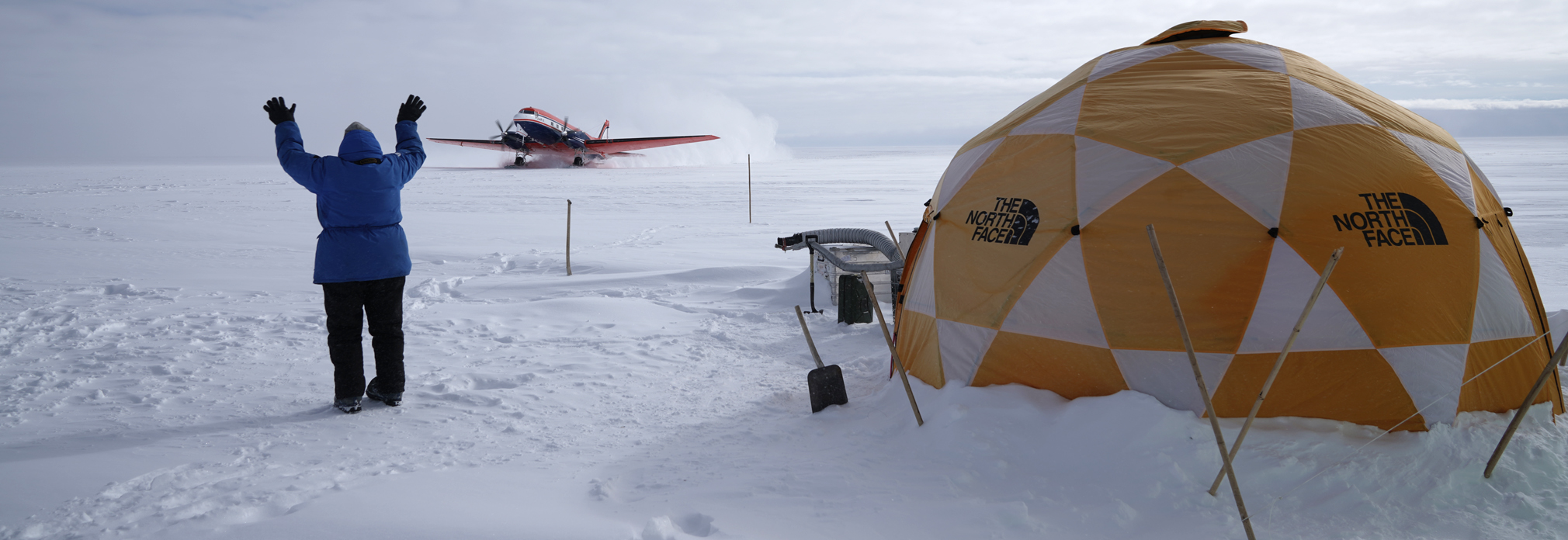 At NEEM, Dorthe waves at Polar 5 as they pull in with Steff and Trevor and reaming equipment to remove an ice blockage that hinders borehole logging.
Surface movement by GPS
Christine Hvidberg and Aslak Grinsted, Niels Bohr Institute
Surface movement by GPS
Christine Hvidberg and Aslak Grinsted, Niels Bohr Institute
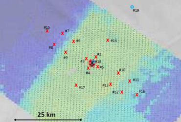
GPS measurements will be used to provide 6 year long records 2015-2020 of surface movement at EGRIP and along NEGIS (The NorthEast Greenland Ice Stream). In 2015, a strain net of 17 GPS poles were established at EGRIP and their 3D positions were measured
(latitude, longitude, height). These poles were re-measured in 2017, 2018 and 2019.
 Map of the strain net at EGRIP showing the 17 poles established in 2015 (red crosses) and the two permanent GPS stations (blue circles). Only the permanent station close to the EGRIP camp was estaablished in 2015. The EGRIP camp is indicated by the black cross. The background shows surface velocity (Imgraft/Grinsted)
AWI North Greenland Traverse (NGT) shallow drilling in NE Greenland
Maria Hörhold and Daniel Steinhage, AWI
AWI North Greenland Traverse (NGT) shallow drilling in NE Greenland
Maria Hörhold and Daniel Steinhage, AWI)
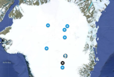
An extensive shallow drilling program is planned in NE Greenland with the aim of extending existing shallow core records of past AWI ice drilling traverses in NE Greenland up to present time. A few ice cores from upstream of EGRIP are also planned. The operation is airborne, using the AWI Basler Polar 5.
May 11-13 Polar 5 flew three times from Kangerlussuaq to EGRIP (and back) with cargo and new members of the EGRIP team and after finishing testing the drill all drilling equipment was finally stowed on the plane May 16. May 17 the first the AWI team successfully completed a shallow drilling 200 km upstream from EGRIP. In the picture you see team members Johannes and Iben with ice core showing the 1889 meltlayer at B16, 200km from EGRIP. Several shallow cores were then drilled on various locations. The map below shows the sites of drilling.
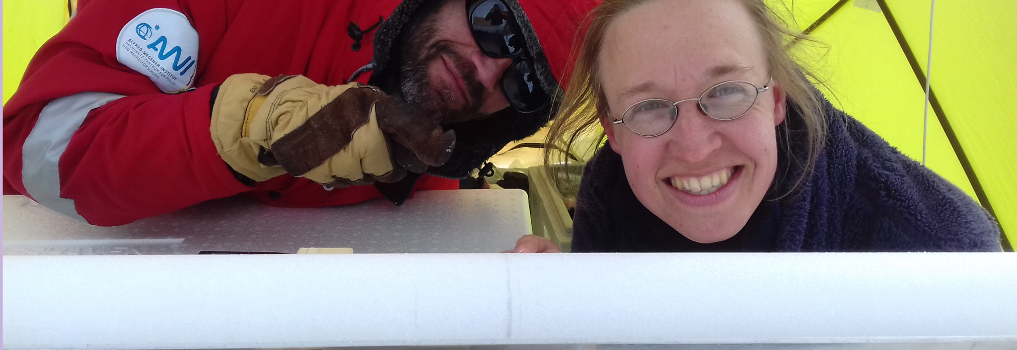
Johannes and Iben with ice core showing the 1889 meltlayer at B16, 200km from EGRIP.
However, the last planned flight mission on May 29 did not go as expected. Weather was really nice so the AWI team took off to drill a shallow core and do a p-RES survey at a point 121 km upstream from EGRIP. Quite unexpectedly, they returned an hour later. They couldn’t land at the site due to crevasses. If you take a look at your Greenland map (or Google Earth for that matter) and plot in the position given below, it is quite remarkable to find crevasses that far into the Greenland Ice Sheet.
Click on the image to open the map (will redirect you to Google Maps)
EGRIP surface processes program
Main responsible: Hans Christian Steen-Larsen, UiB and Maria Hoerhold, AWI
EGRIP surface processes program
Main responsible: Hans Christian Steen-Larsen (Hans.Christian.Steen-Larsen@uib.no) and Maria Hoerhold (Maria.Hoerhold@awi.de)
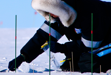
A range of measurements performed within the subject fields mentioned below
- Snow-air water vapor exchange (2016, 2017, 2018, 2019)
- Snow surface and snow pack properties (2016,2018, 2017, 2019)
- Accumulation and precipitation isotope studies (2016, 2018, 2017, 2019)
- Snow-firn transition processes (2016)
- Interstitial-atmosphere air exchange (2017, 2018)
- Remote sensing satellite radiation validation and characterization (2017, 2018)
- Remote sensing of the atmospheric boundary layer structure (2017, 2018)
- Sampling of water vapour isotopes with drone (2018)
Tour with a polar scientist on the Greenland ice sheet
Follow the researcher Anne-Katrine Faber on a tour at her workplace at EastGRIP camp on the Greenland Ice Sheet. As part of the SNOWISO project she does fieldwork here to understand how climate information is stored in the ice. The goal is to make it possible to reveal more details about past climate changes from ice cores.
The video is also available in 360 view.
Mills Cross Radar
Prasad Gogineni, University of Alabama
Mills Cross Radar
Prasad Gogineni, University of Alabama
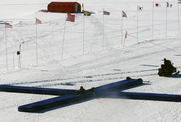
In a collaboration between the University of Alabama, Alfred Wegener Institute for Polar and Marine Research (AWI) and the University of Copenhagen a ground based deep ice sounder (UHF Mills Cross Radar) has been developed.
In 2018 researchers from U. of Alabama, AWI and UCPH made the first tests with the 16 m wide and 16 m long Mills Cross Radar at EGRIP. The radar was placed on a 30 cm high balloon sledge and pulled over the surface by a tracked vehicle (a Pistenbuly)with a cabin in which the electronics is placed and operated.
A drone image of the PistenBully pulling the Mills Cross Radar.
In 2019 a modified version of the Mills Cross Radar was tested at EastGRIP
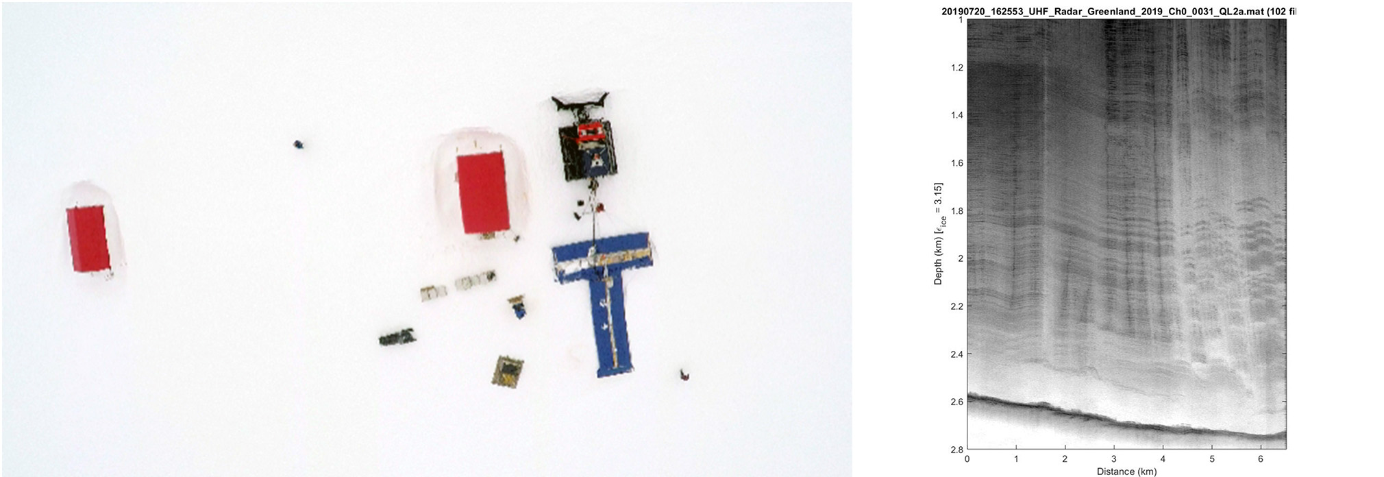
Mills Cross UHF radar in front of the red weatherport. A very first RES image obtained by the radar.
CryoEgg
Elizabeth Bagshaw, University of Cardiff
CryoEgg
Elizabeth Bagshaw, University of Cardiff
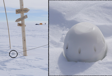
For the Cryoegg Project scientists are creating a 'Cryoegg', a small, wireless sensor that can measure the temperature, pressure and chemistry of the meltwater underneath the ice. The project is funded by the UK Engineering and Physical SciencesResearch Council, and harnesses communications engineering methods to design a bespoke subglacial sensor for fast flowing ice
Surface Rover
Christine Hvidberg, Niels Bohr Institute
Surface Rover
Christine Hvidberg, Niels Bohr Institute
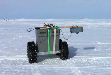
An autonomous GPS based vehicle for making automatic snow surface measurements is under development and will be tested at EGRIP by two people mid-July to beginning of August. Of special interest is testing whether a micro wind turbine will be a feasible source of energy.
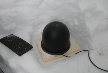
Earthquake station at EGRIP
Trine Dahl-Jensen and Tine B. Larsen, Geologiscal Survey of Greenland and Denmark - GEUS
Earthquake station at EGRIP
Trine Dahl-Jensen and Tine B. Larsen, Geologiscal Survey of Greenland and Denmark - GEUS
Starting in 2000, the seismological groups at KMS and GEUS – now all at GEUS – have placed earthquake seismic stations at over 20 sites in Greenland, both on the coast and on the ice sheet. They record globally occurring earthquakes, and use the data to investigate the local structure beneath and between the stations. A station was placed placed at EGRIP in a garage tent in 2015, and in 2016 the station was moved to the newly constructed core buffer trench. The station is solar/battery powered and collects data onto a memory chip. Once a year the memory chip is exchanged and the station is maintained.

PARCA AWS station system maintenance
Koni Steffen, ETH Zürich, CIRES Colorado
PARCA AWS station system maintenance
Koni Steffen, ETH Zürich, CIRES Colorado
During the annual maintenance of the Automated Weather Stations in N-Greenland, the EGRIP camp will be re-fuelling station and base for the PARCA team for several days in May. PARCA uses a Twin Otter air craft.
GLISN seismic network
The GLISN project
GLISN seismic network
The GLISN project
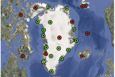
The GLISN network operates several permanent seismic stations on the Greenland ice sheet, e.g. at Summit and at the NEEM site.
The project has established a real-time sensor array of these many stations to enhance and upgrade the performance of the existing Greenland seismic infrastructure for detecting,locating,and characterizing glacial earthquakes and other cryoseismic phenomena, and contribute to ourunderstanding of Ice Sheet dynamics. Complementing data from satellites, geodesy, and other sources and in concert with these technologies, GLISN provides a powerful tool for detecting change and will advance new frontiers of research in glacial systems; the underlying geological and geophysical processes affecting the Greenland Ice Sheet; interactions between oceans, climate, and the cryosphere; and other multidisciplinary areas of interest to geoscience and climate dynamics. The development of the telemetry infrastructure linking the sites together into a coherent framework creates the temporal resolving capability and potential for rapid scientific response.
Normally, during the annual maintenance of the sites, the team uses EGRIP as a re-fuelling and over-night stop. However, in 2019 no maintenance is planned except for the maintenance provided by the borehole logging team at NEEM.

MAGPIE
Magnetotelluric Analysis for Greenland and Postglacial Isostatic Evolution - Clint Conrad, University of Oslo
MAGPIE
Magnetotelluric Analysis for Greenland and Postglacial Isostatic Evolution - Clint Conrad, University of Oslo
 The MAGPIE project began in April 2019 with funding from Forskningsrådet, which is the Research Council of Norway. The ultimate goal of the project is to develop better estimates for current and recent melting of the Greenland Ice Sheet.
Follow their progress on the MAGPIE project website.
Geophysics research on the Greenland Ice Sheet
Follow the researcher Kate Selway carrying out research at the EastGRIP camp on the Greenland Ice Sheet in the summer of 2019, studying the ice sheet and the underlying Earth to improve models of ice sheet behaviour and sea level rise.
Airborne radar measurements at EGRIP and in NE Greenland
Daniel Steinhage, AWI
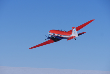
Airborne radar measurements at EGRIP and in NE Greenland
Daniel Steinhage, Olaf Eisen and Tobias Binder, AWI
The AWI crew used the EGRIP camp as base for operations of the AWI Basler (DC3) carrying German radar and survey equipment. For this purpose, three extra LC-130 flights with fuel for the Basler was scheduled in 2016 and flight crew and scientists stayed at EGRIP during operations. AWI placed a fuel depot at EGRIP of 28,800 liter for operations in 2017. However, due to certification issues, the planned radar campaign was postponed in 2017 to 2018. In 2018 the radar campaign took place in May.

Geophysical Constraints on the Crust and Upper-Mantle Structure of Greenland
Meredith Nettles, LDEO Columbia Uni.
Geophysical Constraints on the Crust and Upper-Mantle Structure of Greenland
Meredith Nettles, LDEO Columbia Uni.
This study aims to characterize the seismic velocity structure of Greenland's crust and upper mantle in three dimensions; and to integrate these results with gravity and heat-flow data, laboratory estimates of material properties, and petrological data to map variations in temperature, composition, and heat flux.
The project makes use of seismic data from the NSF- and internationally funded GLISN seismic network, supplemented by targeted collection of data at seven temporary seismic stations.
The research will lead to an improved understanding of the crust and mantle structure of Greenland, the way this structure has evolved with time, and its influence on modern day geophysical processes in the cryosphere and solid Earth. The results of the study will provide inputs for ice-sheet models and models of glacial isostatic adjustment. The accuracy of both types of models is critical for accurate predictions of sea-level rise. The findings of this study will also be relevant for understanding continental assembly and preservation worldwide. The seismological models derived in this project will also allow improved estimates of source parameters for tectonic and glacial earthquakes.
In 2015 a fuel depot of 1200 liter was placed at the apron at EGRIP in support of the project when EGRIP was packed down. During summer, 2016, seven temporary seismic stations, which was deployed in summer, 2014 was demobilized. Six of these stations are located on the northern part of the Greenland Ice Sheet, distributed approximately evenly around the EGRIP location near the onset of the Northeast Greenland Ice Stream. The six stations were reached by Twin Otter, using the EGRIP camp and skiway as a base.
Windsled team
Prof. Jason Box, GEUS
Windsled team
Prof. Jason Box, GEUS
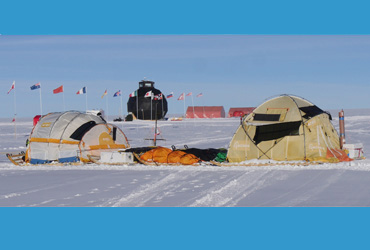
A Spanish team using a wind sail driven research platform reached EGRIP on June 19 2017. The team collected snow samples enroute, and operated an accumulation radar on the flow line from Summit to EGRIP.
EGRIP provided space for people for pull-out to Kangerlussuaq by LC-130 EGRIP flights. Equipment was stored at EGRIP in 2017 and returned to Kangerlussuaq in 2018.
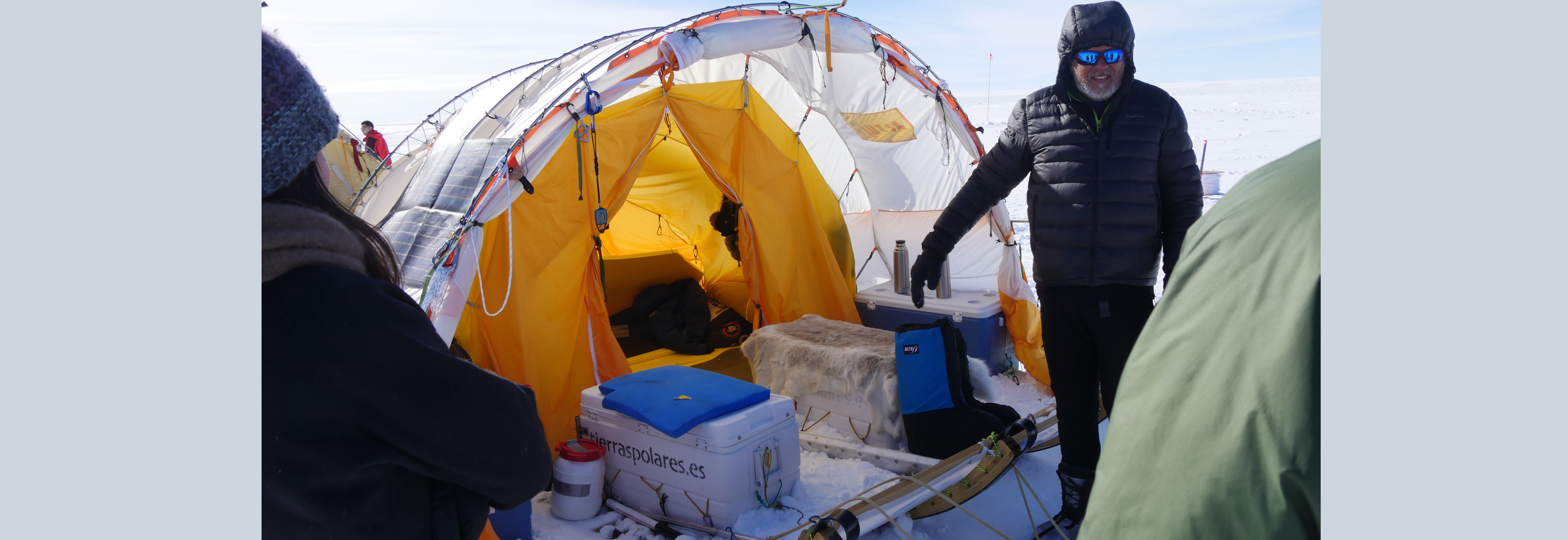 A guided tour of the incredible wind sledge that travelled some 20,000 kilometers in Antarctica, Greenland and the polar regions. The ‘drivers’ sit on the two boxes and steer the sail/kite that is fixed in a 350 m long line. The other expedition members can rest in a tent on a second attached sledge. The sledge weighed 2 tons and it could move up to 400 km in 24 hours (record) or it be stuck for days.
Remote sensing reference station at EGRIP
Waleed Abdalati, CIRES Colorado
Remote sensing reference station at EGRIP
Waleed Abdalati, CIRES Colorado
Surface equipment 1 km SE of EGRIP was set up in 2015. The equipment measured surface snow properties with the aim to obtain ground truth readings for satellite observations.

RADIX Drilling
IceFlow Project
RADIX Drilling
IceFlow Project
The RADIX system: Design and construction of a prototype of a fast-access ice drilling equipment (RADIX) for prospecting a potential drilling site in Antarctica for the “Oldest Ice Project” was started in 2012 at the University of Bern. The aim was to develop a system using minimal resources and logistics support.
The RADIX drill is hydraulically powered and designed to drill in a continuous mode a 20 mm hole at a penetration rate of 10 mm/s. After the prototyping phase, the final goal was to drill several holes at potential deep drilling sites to or near to bedrock. The holes would be used for temperature and other downhole measurements. The drilled ice chips and/or core samples from specific depths could be analyzed with the main goal to determine the age of the ice near the bottom and to assure the integrity of the ice core record in order to determine the site for the main deep drilling.
After an initial feasibility test on an Alpine Glacier further tests were made in 2015 on Renland and 2016 at EastGRIP. These tests included the evaluation of suitable firn hole casing and its tight connection at the base, tuning the fluid recycling system, and implementing a new fast access 40 mm firn drill. In 2017 a first drilling of 15 m below the casing at nominal penetration rate was done.
In 2018 an attempt was made to drill a rapid access hole through the 2600 m thick ice, 28 km from the EGRIP camp with an in-development drill setup from U. of Bern. The selected site is where there are large basal structures in the ice that are not understood. The vision was to drill through the disturbed ice just outside the shear margin of the North East Greenland Ice Stream (NEGIS). Unfortunately, the attempt was not successful and at present, we regard it unlikely that this high risk - high gain initiative will succeed.
 A guided tour of the incredible wind sledge that travelled some 20,000 kilometers in Antarctica, Greenland and the polar regions. The ‘drivers’ sit on the two boxes and steer the sail/kite that is fixed in a 350 m long line. The other expedition members can rest in a tent on a second attached sledge. The sledge weighed 2 tons and it could move up to 400 km in 24 hours (record) or it be stuck for days.
Popular scientific articles about EGRIP camp
Ice core drilling camp on the Greenland Ice Sheet
For the 2017 field season Anne-Katrine Faber (University of Bergen) joined the EGRIP camp work. Read more about her stay at EGRIP in the article from the Geografisk Orientering Magazine (article in Danish).
Secrets of the Ice
For the 2018 field season Prof Ilka Weikusat (University of Tuebingen and AWI), 3 Uni Tuebingen-Alumni (Nico, Julien, Sonja) + 2 more Uni Tuebingen co-affiliates (Daniela, Jan E.) joined the EGRIP camp work. Read more about their stay at EGRIP in the article from the Uni Magazin (article starts on page 15 of the pdf).
Through the Greenland Ice Stream
Popular scientific paper about the EastGRIP project and drilling through an ice stream. Read more in the paper from the journal Priroda Nature (in Russian).

